
Colombia 4: Pre-Columbian Tombs

"Neiva to San Agustin" From Neiva we set off to visit a series of pre-columbian tomb sites. It’s always fun having these little tourist stops to punctuate the meandering of our ride, but to be honest, while they are interesting, it’s the small roads and backcountry surprises that are the real jewels of this adventure. Off the beaten path, the road less traveled, is where the best memories are made. That was my favorite part of climbing all the state highpoints in the U.S., don’t get me wrong, I live for mountains, but trying to string a few state highpoints together on a road trip, takes you far from the main roads, and through places most people never see. You really get to zig and zag through places no one would ever go unless they lived there. And that’s what the last two weeks have done.We wound our way out of Neiva, turning onto a small paved road, and then another road, passing through the little towns of Yaguará, Iquira, and Tesalia, before reconnecting with our friends’ route (highlux.co.nz) at Paicol. Yaguará was a quiet town near a lake, but not touristy. We stayed at a sweet little hotel where the lady made us coffee while her parrot preened Neon’s dreads. We left Yaguará in the pouring rain, assuming it would let up later in the morning, but it never did. It slowed occasionally, but not for long. The closer we got to Paicol, the harder it rained.
 It was kind of ridiculous how hard it rained; it was warm enough, but I was soaked to the bone. There was so much water on the road, even on the downhills, that it rose up and over my tires, creating a wall of water that splashed my legs as though I were riding through an irrigation canal. A stream of pink flowed from my hair—drip, drip, dripping on my thighs, then spread out like a Helen Frankenthaler painting over my thighs. I laughed and sang as I rode through the rainy wall of water. Neon didn’t find the ridiculously wet rain as amusing as I did. I think maybe he’s allergic to rain. Perhaps it’s having grown up in the Pacific Northwest, in the Seattle area, that allows me to (sometimes) find joy in the rain. Although, I was very happy when we finally made it to Paicol, and to a cozy hotel room out of the wet, wet, rain.

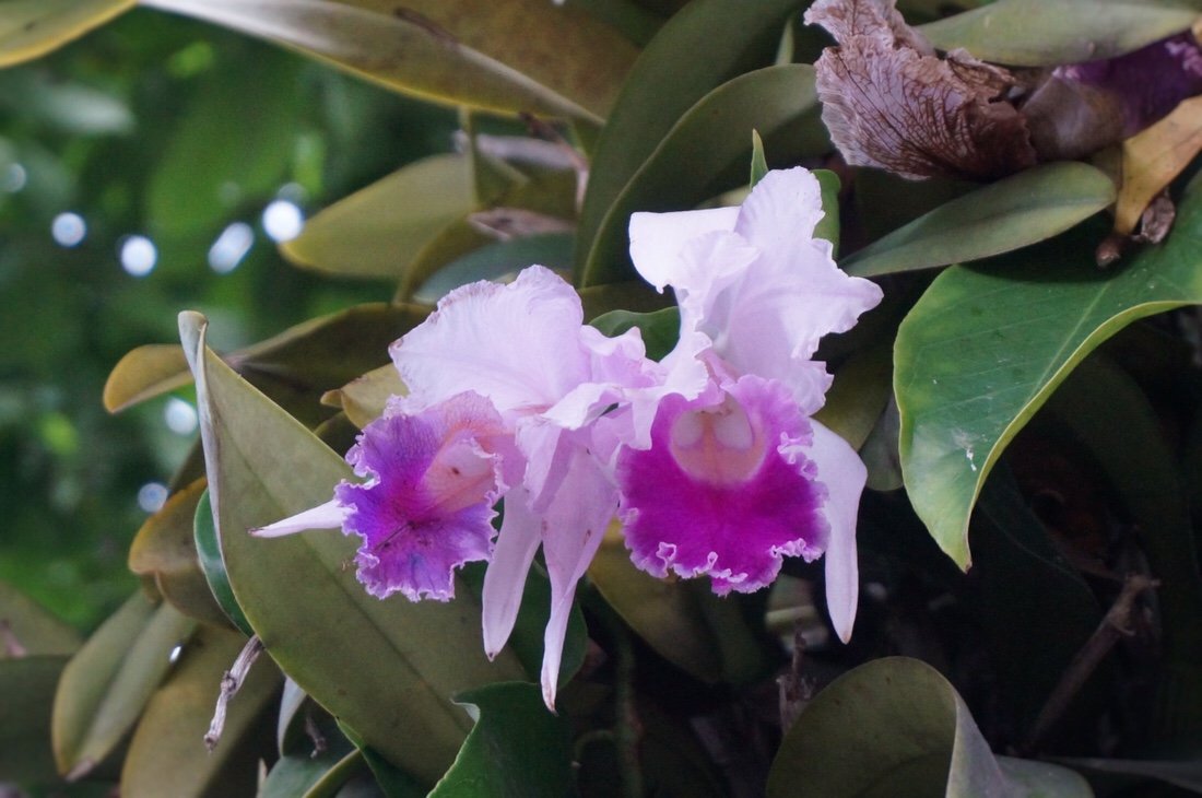 Many of the trees in Paicol had orchids growing on them, and we were lucky enough to be there while they were all blooming.•After taking a day off in Paicol we made our way to La Plata and then to Tierradentro, the first of the pre-columbian tomb sites we planned to visit.
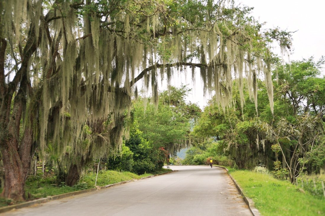
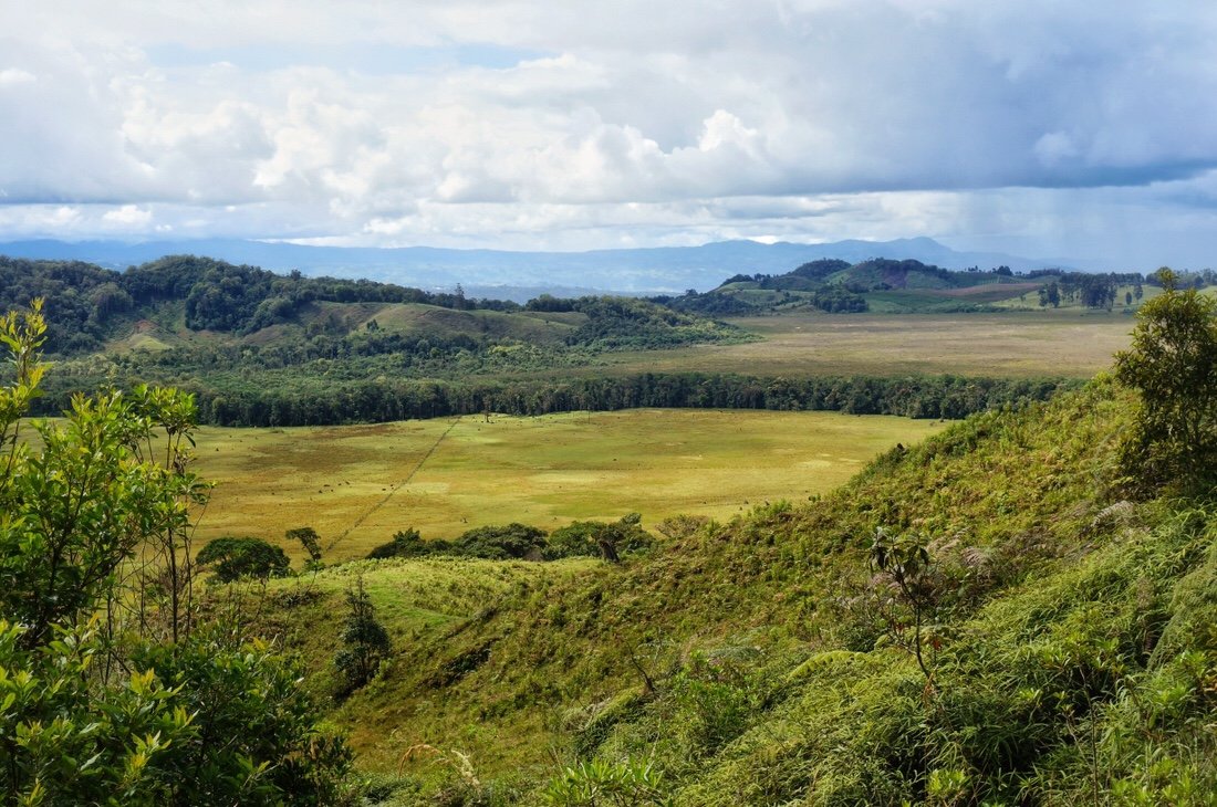
 Rio Paez, and an interesting shelf of land. •
 I had been a little hesitant to venture this far out of the way, as Tierradentro was a whole day’s riding, out and back, and uphill (seemingly in both directions; how does that work?), from the direction we were heading. But of the sites we visited, Tierradentro was my favorite, and for all those off the beaten path reasons.
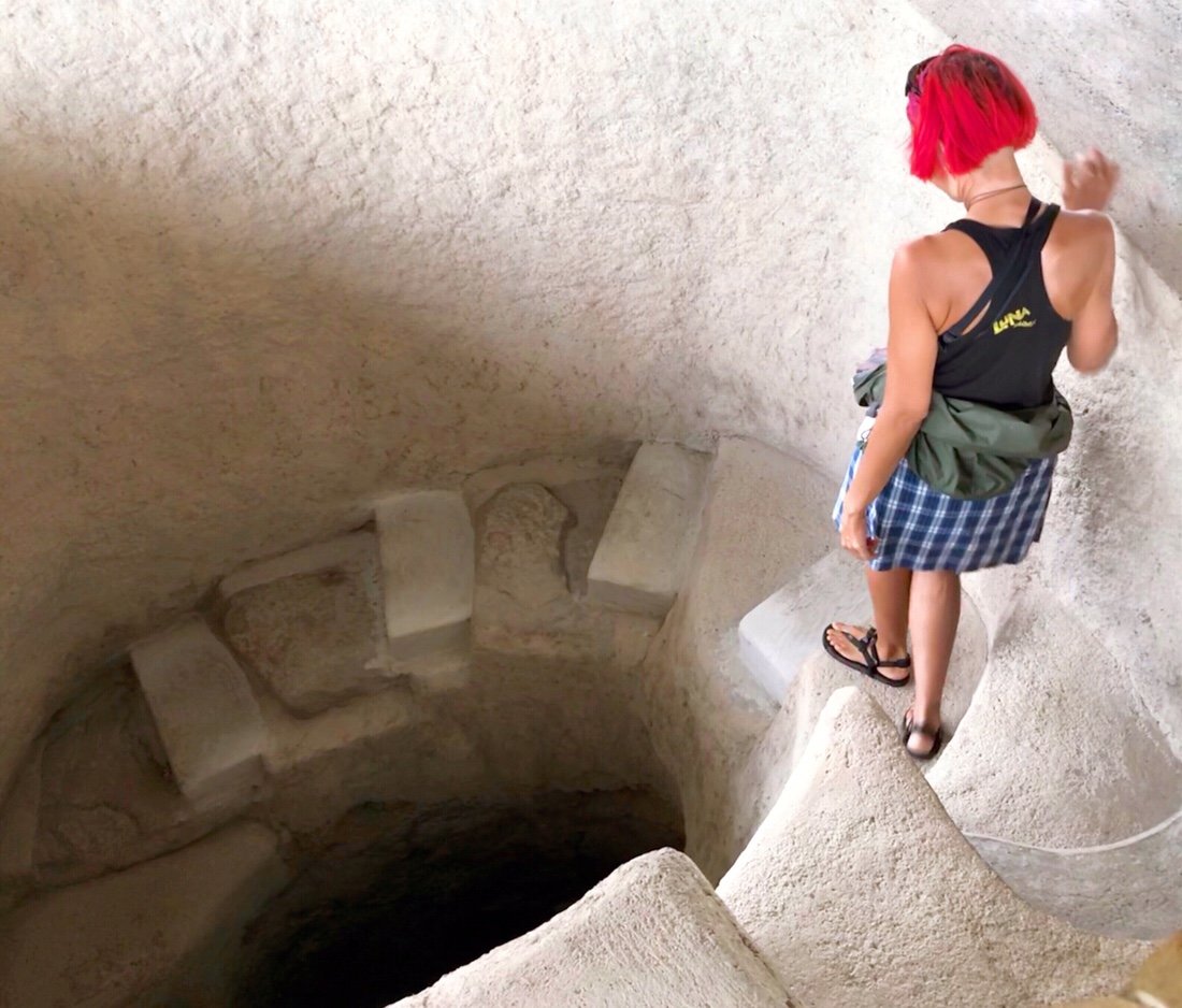
 The tombs in Tierradentro were built around the 6th century AD. The tombs that comprise the Tierradentro Archeological Park are made up of five different sites scattered around the area along a fourteen kilometer loop hike. One of the guards told us that there were primary tombs and secondary tombs, and that the bodies were left to decompose in the primary tombs for five years, then the bones were burned and put into urns in the secondary tombs.
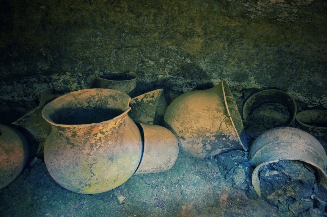
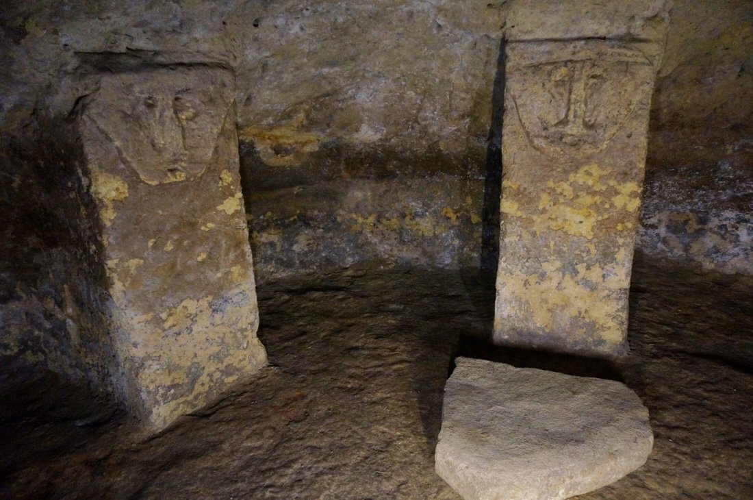
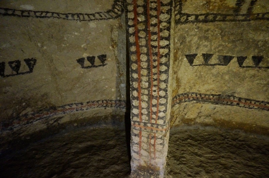
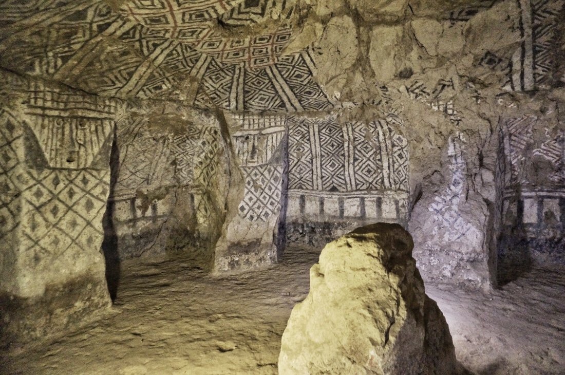 Some of the tombs were elaborately painted with designs. And most of the columns inside the tombs had carved faces at the top of the Column.
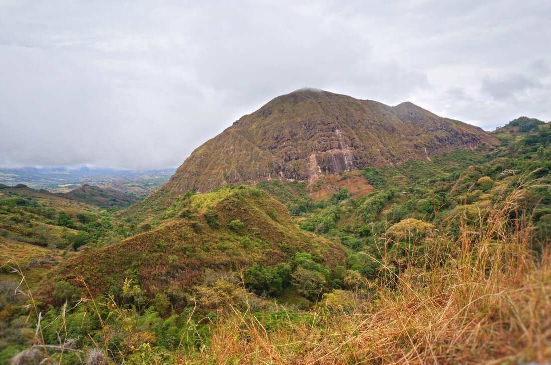
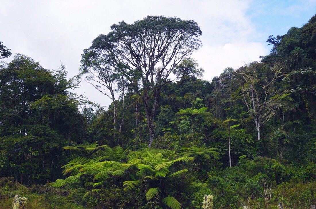
 One of the sites in Tierradentro showcased a few statues, but not as many as the archeological parks around San Agustín.•The tombs were impressive, but it was the fourteen kilometer loop hike around Tierradentro, connecting all the tomb sites, that held my interest. It was a beautiful hike through lush green hills, past coffee farms, up and over ridges, across valleys, and along narrow ridge tops. The trail isn’t just the park trail, it’s the local path, the only access to many of the farmer’s homes—it’s a local passageway between farms and homes and towns, from ridge to valley to ridge.
 It's common to see coffee planted together with banana plants.•
 Coffee beans still on the tree.•
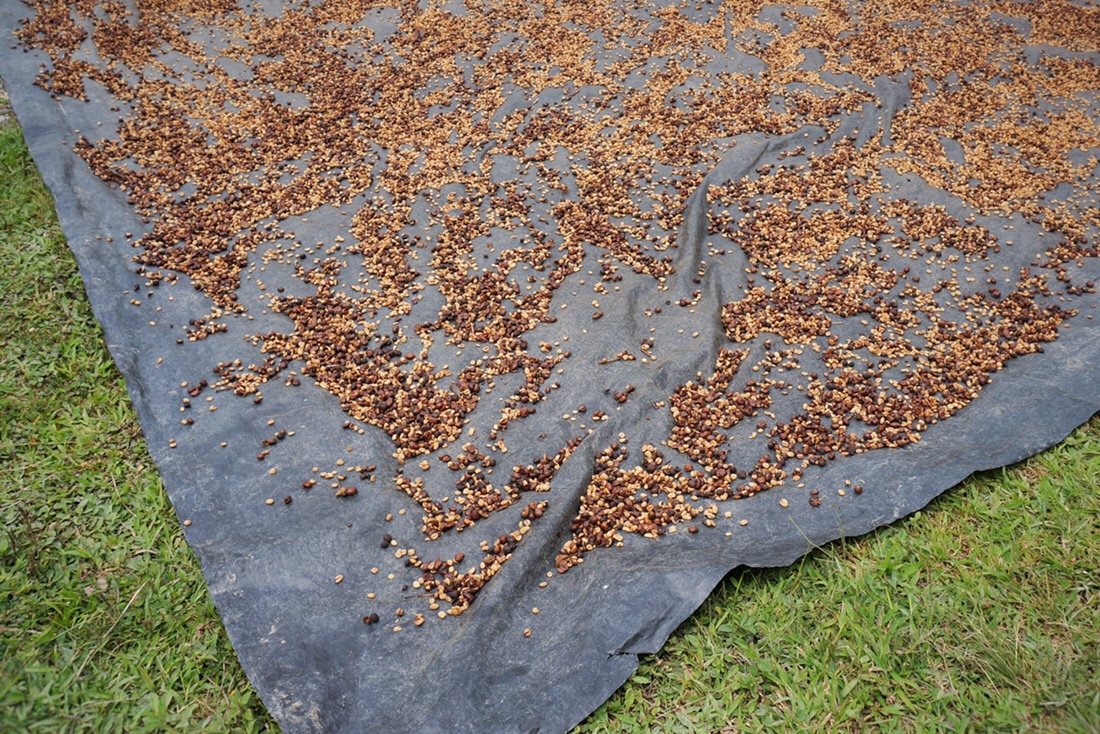 Coffee beans drying in the sun outside someone's home.•
 Most of the pedestrian bridges in the area are constructed from Bamboo.•
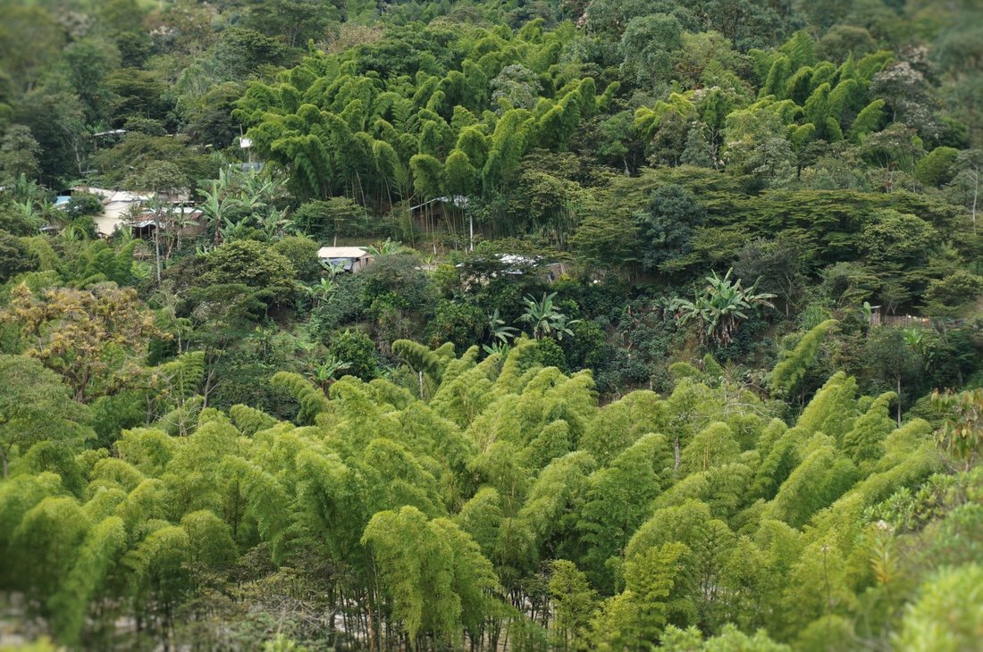 The feathery looking plant is bamboo. It grows quite tall and is very strong. Many of the homes and buildings in the rural areas are constructed from bamboo, rocks, and mud.•We chatted with several locals during our (all day) hike. At Alto el Aguacate we met a local who was eager to show us one of the unguarded tombs; he told us that his ancestors built the tombs and at that time they were cannibals. At Alto el San Andres the guard told us that though the area is currently inhabited by the Paez (Nasa) people, they are not the people who built the tombs, and that little is known about who made the tombs, or why they left the area. And before that, at Alto el Duende, another guard told us that it was the Paez people who built the tombs. Neither our park brochure, or an online search, cleared this up. There just seems to be very little, if any, information about who built the tombs. Everything together made Tierradentro a beautiful package linking the past with the present along old footpaths.
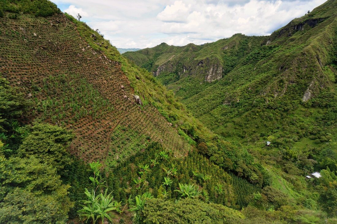
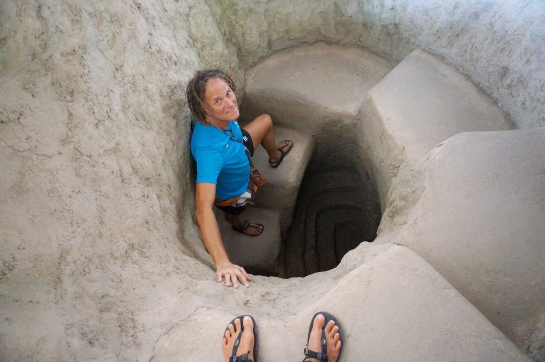
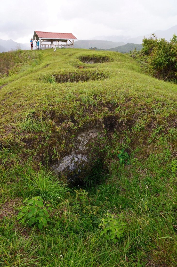 The tombs at Alto el Aguacate in Tierradentro haven't been restored. Some of them have been covered with a shelter to keep rain out, and been cleared of debris and plants, while others just look like holes in the ground (until you peek inside to see the undulation of old steps, and further inside, columns supporting the interior).•
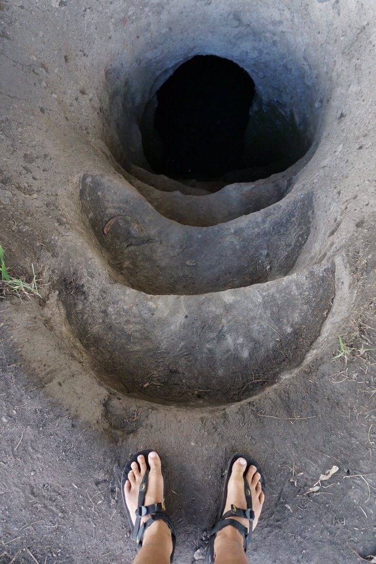 One of the cleaned up, but unrestored, tombs at Alto el Aguacate.•
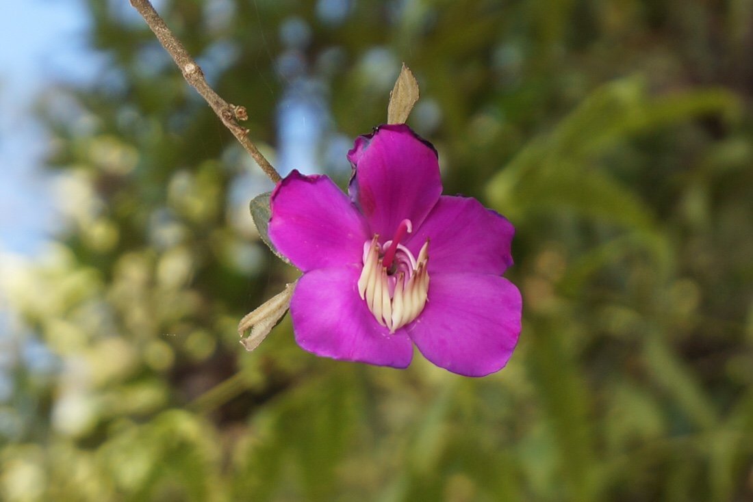
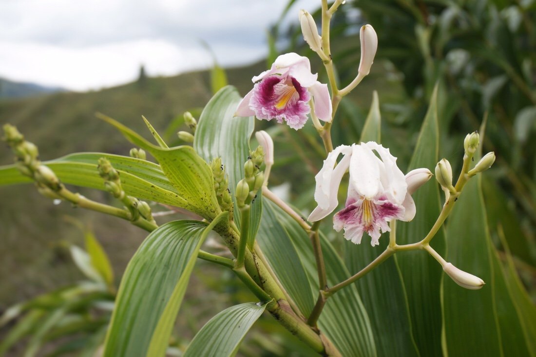 We've been seeing a lot of wild orchids in bloom. These were particularly beautiful, growing on tall stalks about five feet high.•
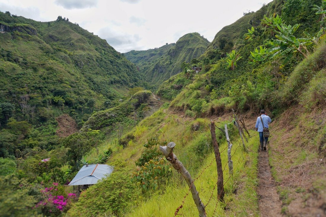
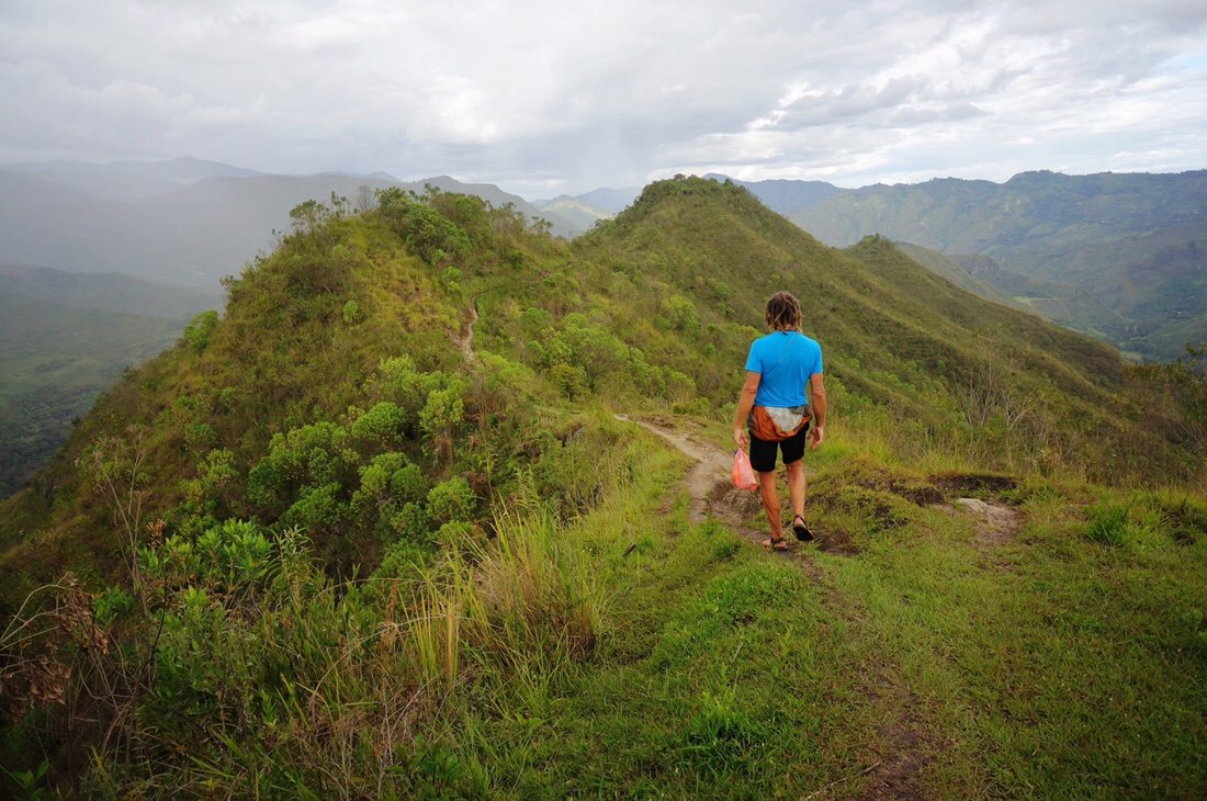 The remainder of the hike, from Alto el Aguacate back to our hostel in the town of Tierradentro, was along a beautiful narrow ridge top.•After Tierradentro we headed back to La Plata, and then took small dirt roads, passing through La Argentina, Oporapa, Saldoblanco, Bordones, San Jose de Isnos, Obando, and into San Agustín.
 Sunday morning in La Plata: motorcycles are the most abundant form of transportation here.•
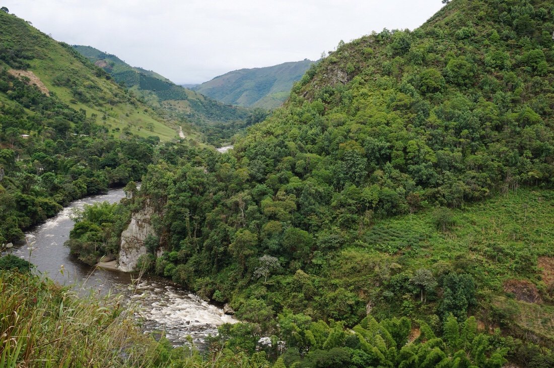 Rio La Plata, from our ride into La Argentina.•
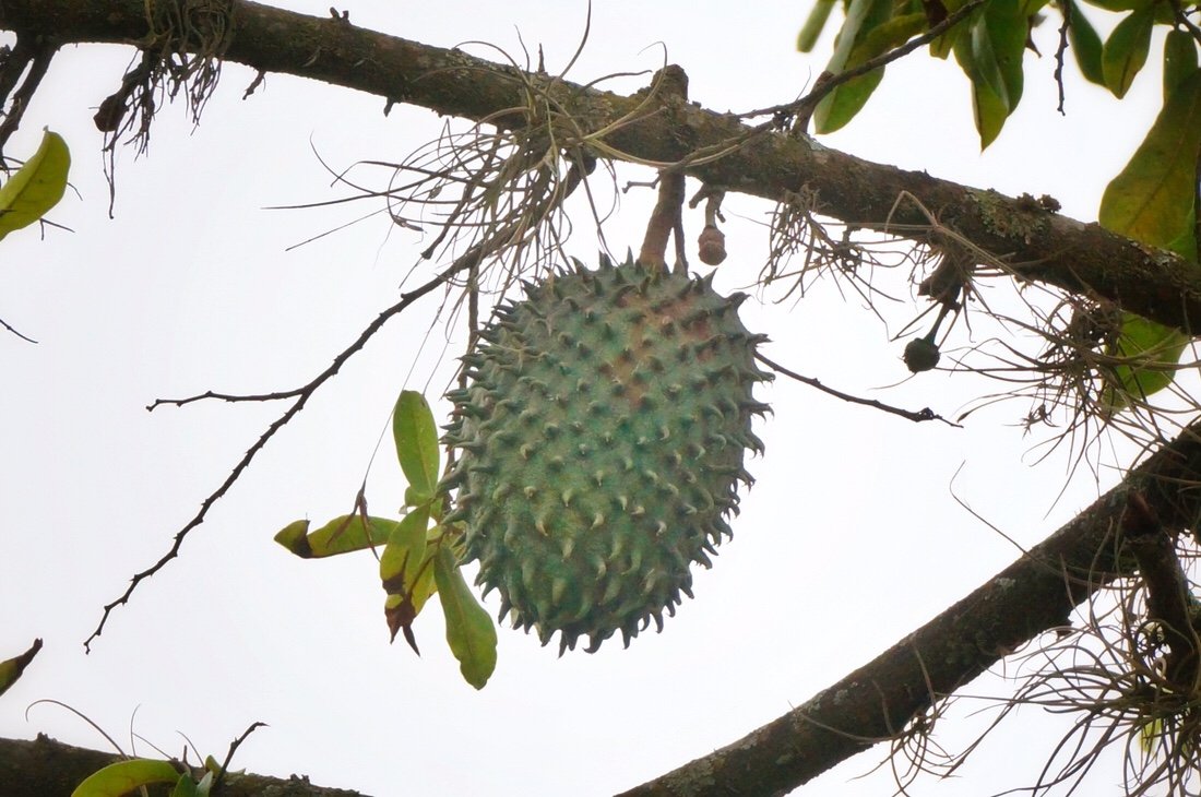 An interesting looking fruit on a tree on our way into La Argentina.•We’re never sure what to expect from these backcountry routes, what our reception will be, if we’ll find camping, hotels, water, or good stores for resupply, but everything always seems to work out. We rode into La Argentina in the rain. I had seen a couple of hotels on the map, but what's on the map doesn't always exist when you actually get there. On the way into town we met a man on a motorcycle, Javier; he stopped to see if we needed help finding anything. We told him we were looking for a cheap hotel with wifi. He led us to a small hospedaje (hotel) not far from the main square. It was perfect: big room, good internet, and light on my budget so we decided to take a day off. We spent the next afternoon with Javier and his family sharing a meal and stories about Colombia and our other travels.
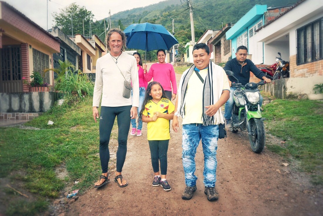
 Another fruit they grow in this part of Colombia is dragonfruit. It's a fruit that grows on a vine-like cactus. The fruit is slightly sweet, not tangy at all, and has a texture sort of like a soft kiwi.•Out of La Argentina the landscape alternated between wild land and cultivated farmland (mostly coffee) on steep mountain ridges. Along the way we encountered several road closures, some due to landslides and others where they were in the process of widening the road. At the first closure we encountered the lady radioed ahead to see if we could get through; after radioing ahead she told us that they were getting ready to do an explosion, but that we had time to ride through. I wondered how much “time” as we rode through the road block. I really had to pee, but I didn’t dare take the time to stop. Later in the day we had to wait for an hour at one of the closures. I ate lunch while we waited, and Neon passed the time helping a young boy who was eager to practice his English.


 This road wasn't closed, but the photo illustrates some of the damage we've seeing from the recent rains.•
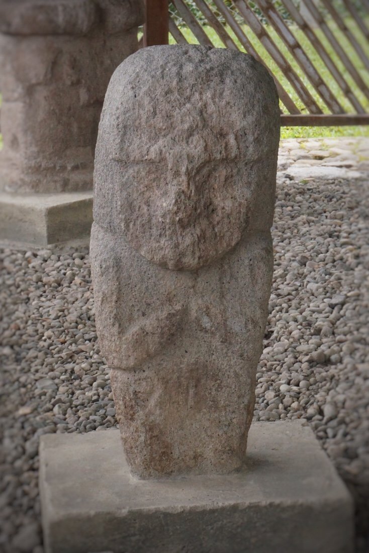
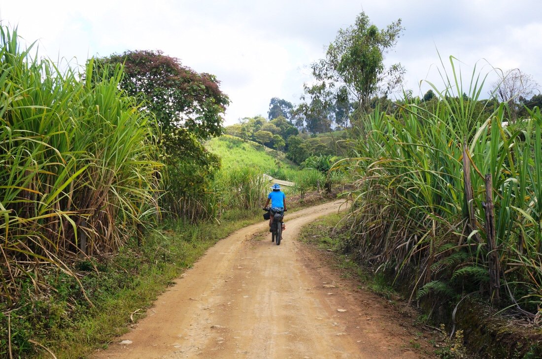 As we got closer to San Jose de Isnos the steep mountain ridges, planted mostly with coffee, slowly shifted to rolling hills, mostly planted with sugarcane.•There was a lot of uphill climbing as we made our way to San Agustín. After La Argentina, we stopped for the night in Oporapa and San Jose de Isnos. Out of Isnos we took a short detour to visit “Alto de Los Ídolos". Alto de Los Ídolos is a small site; it contains statues that had once guarded tombs that were buried beneath small mounds. I had a moment of shock when I found out how much it cost to get into the small park, until I learned that the cost also covers entrance into the main park in San Agustín as well as a few other sites in the area.
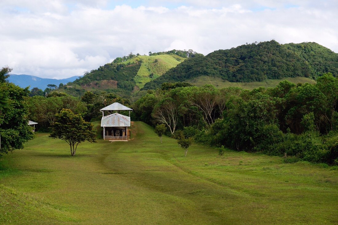

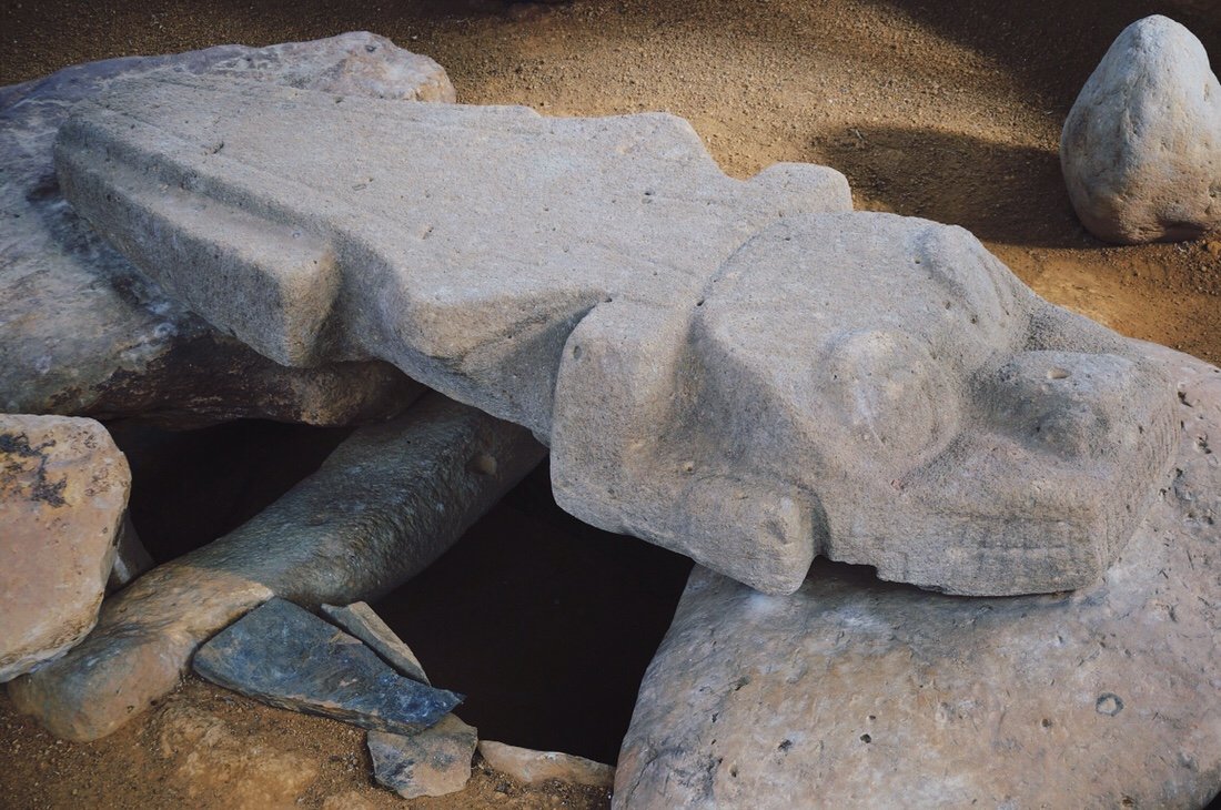 The sign on site said the statue guarding this tomb was of a crocodile, but it looked to me like the flying dog in the movie "The Neverending Story".•
 A group of school kids visiting Alto de Los Ídolos.•From Alto de Los Ídolos it was a short ride into San Agustín, with two river crossings, which meant going way down, and then climbing back up from the river valley. They weren't our biggest climbs, but after all the climbing that we've done since La Plata, we were ready to take a couple of days off in San Agustín.
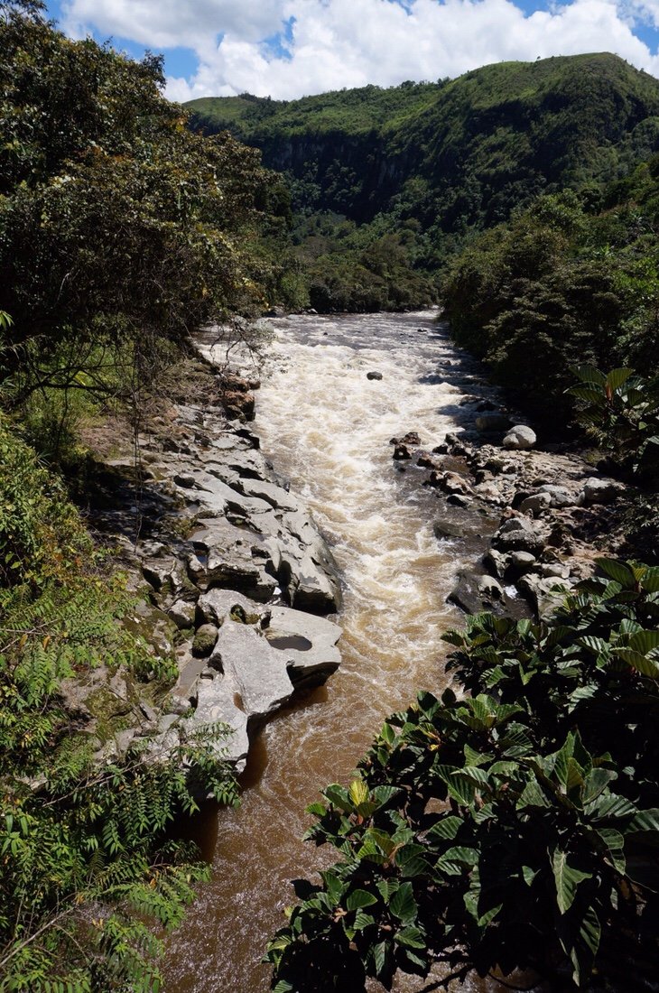 On our ride into San Agustín we crossed over Estretcho del Magdalena, a narrow, deep channel of the Rio Magdalena not far from its headwaters. This was the fourth and final time we crossed the Rio Magdalena since we left Bogota. •
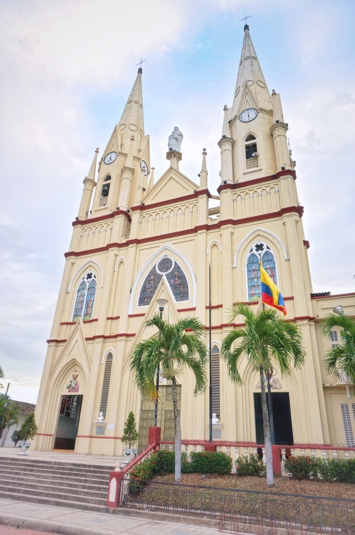
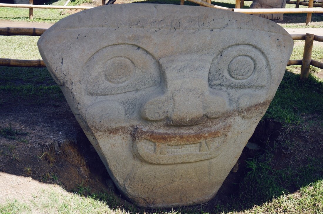
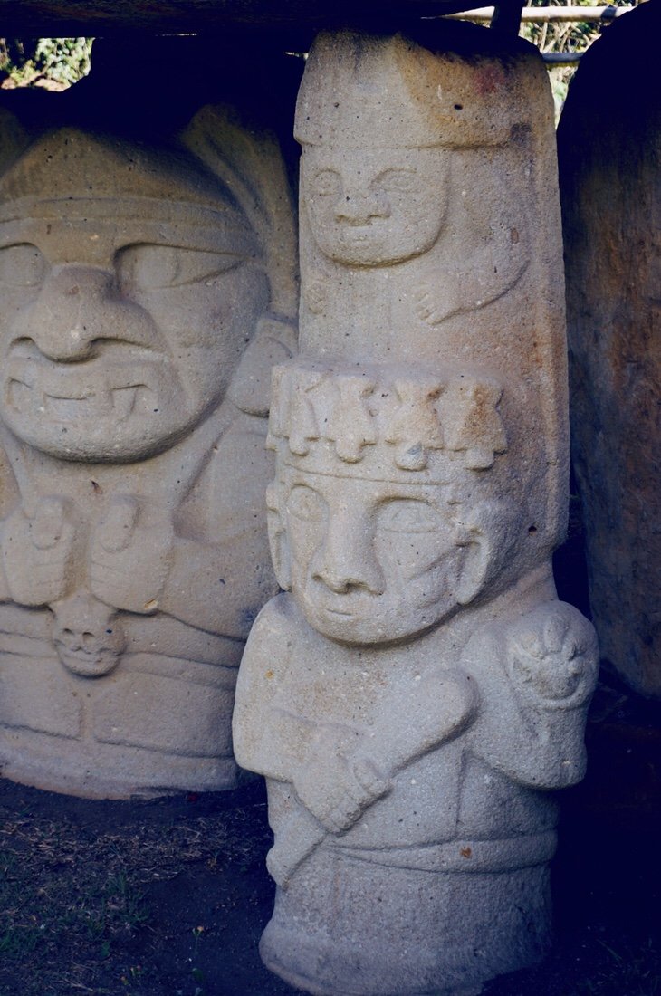
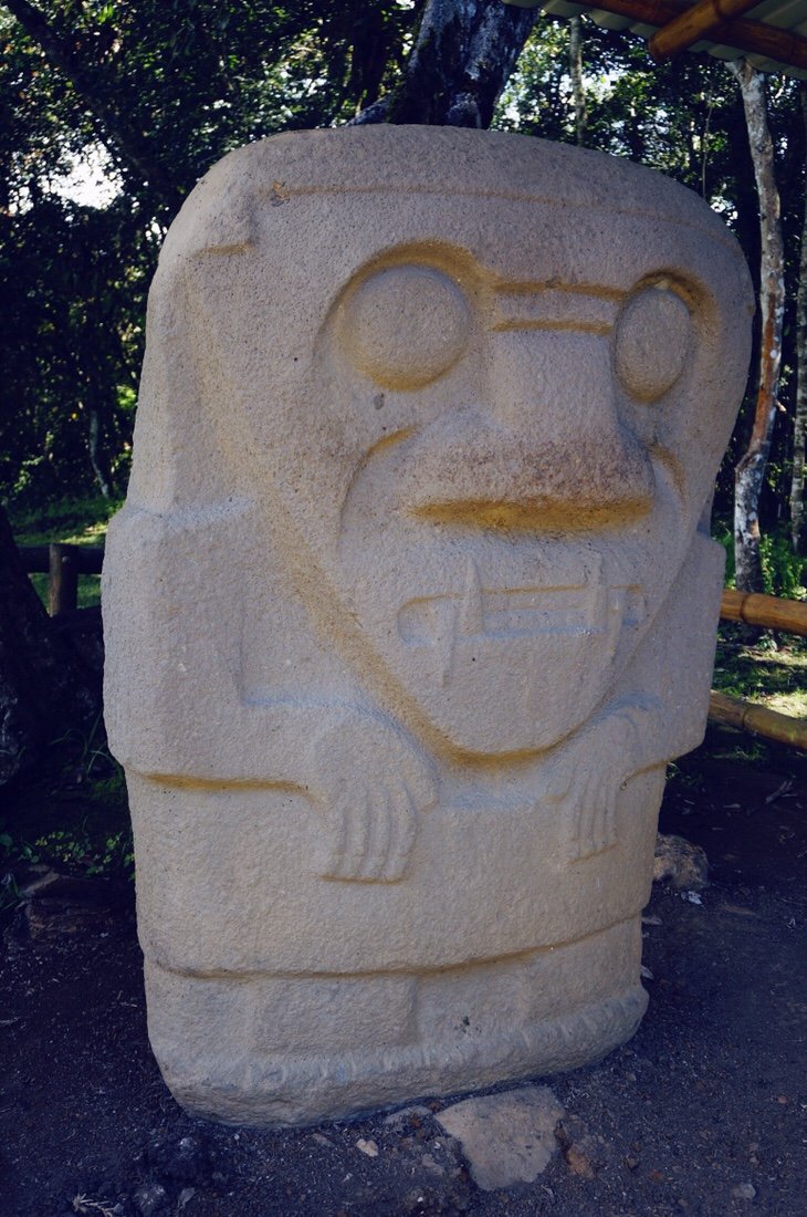
 Rainbow over the church in the main square in San Agustín.•We took a couple of days off in San Agustín, resting, eating ice cream, and visiting the San Agustín archeological park and the much smaller site at El Tablón. According to the sign on site at San Agustín, the burial mounds and funerary structures were built about two thousand years ago, and that interpretations of the purpose of the statues ranged from serving as guardians of the tombs to links between the human world and the animal world.
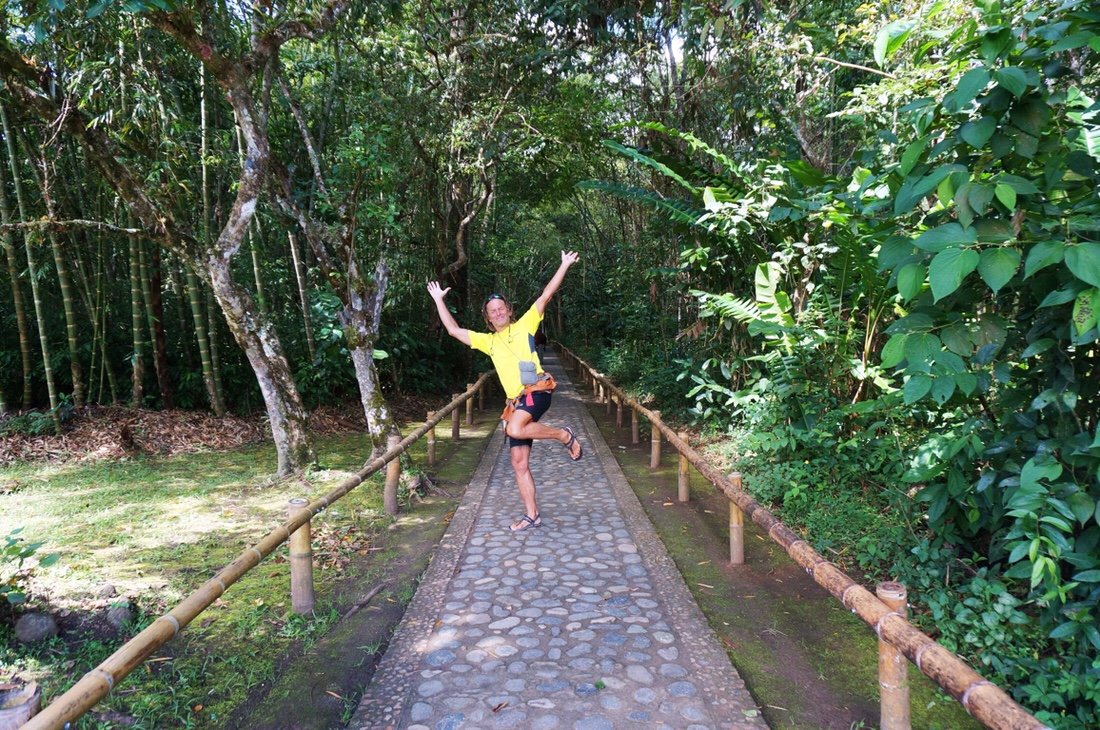 The hike through the San Agustín archeological park was only a couple of kilometers, but I think it was our favorite part of the visit.
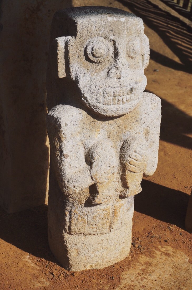
 Some of the statues at San Agustín are almost comical while others appear more serious--some are caricatures of humans while others are caricatures of animals.
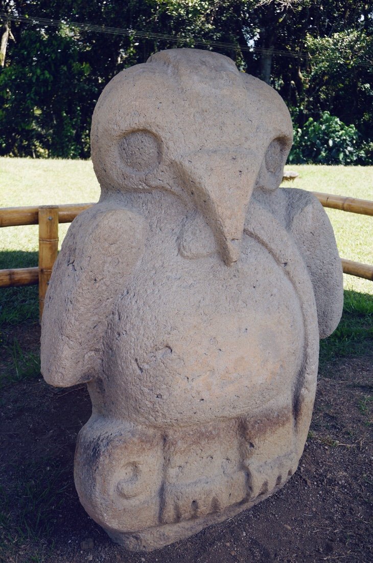

 •
•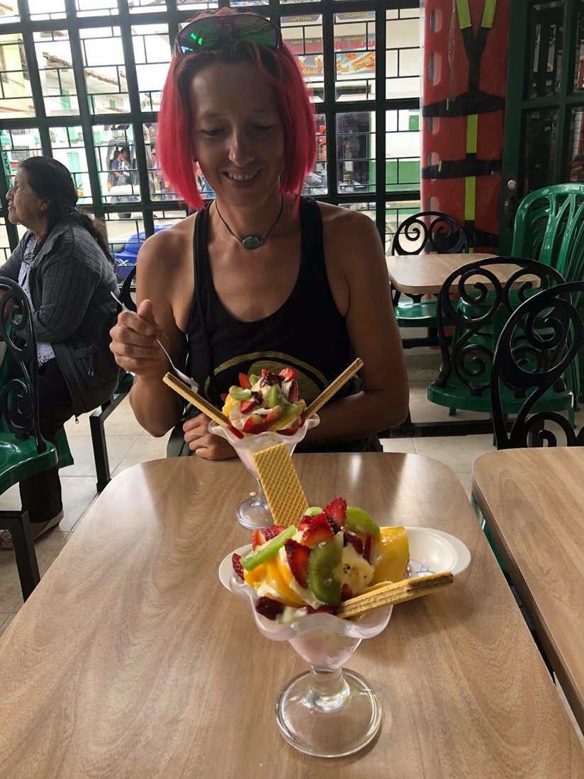 The best "sundae" I think I've ever had: ice cream, thick cream, and fresh fruit, garnished with wafer cookies. I'm only ~90% vegan these days; eating mostly vegan meals, but with the occasional ice cream in town, the occasional can of sardines while we're riding in the backcountry, and on an even rarer occasion a little cheese. Canned beans are gross in Colombia; they have chunks of bacon fat in them. I've tried picking out the fat chunks and rinsing the beans, but I can still taste the pig.•NEXT UP: The infamous narrow and curvy dirt road of southern Colombia: The Trampolin de la Muerte._____________________If you enjoy my posts and would like to make a contribution toward my travel expenses, or just buy me a coffee in appreciation, you can send an amount of your choosing through my paypal.me address:paypal.me/inthewildland•You can sign up to receive The Redheaded Nomad’s blog posts in your email inbox; sign up at the bottom of any page on my website: theredheadednomad.com•For more frequent updates, follow me on Instagram at: instagram.com/theredheadednomad•You can also find me on Facebook at: facebook.com/redheadednomad_____________________