Hayduke - Needles to Hite

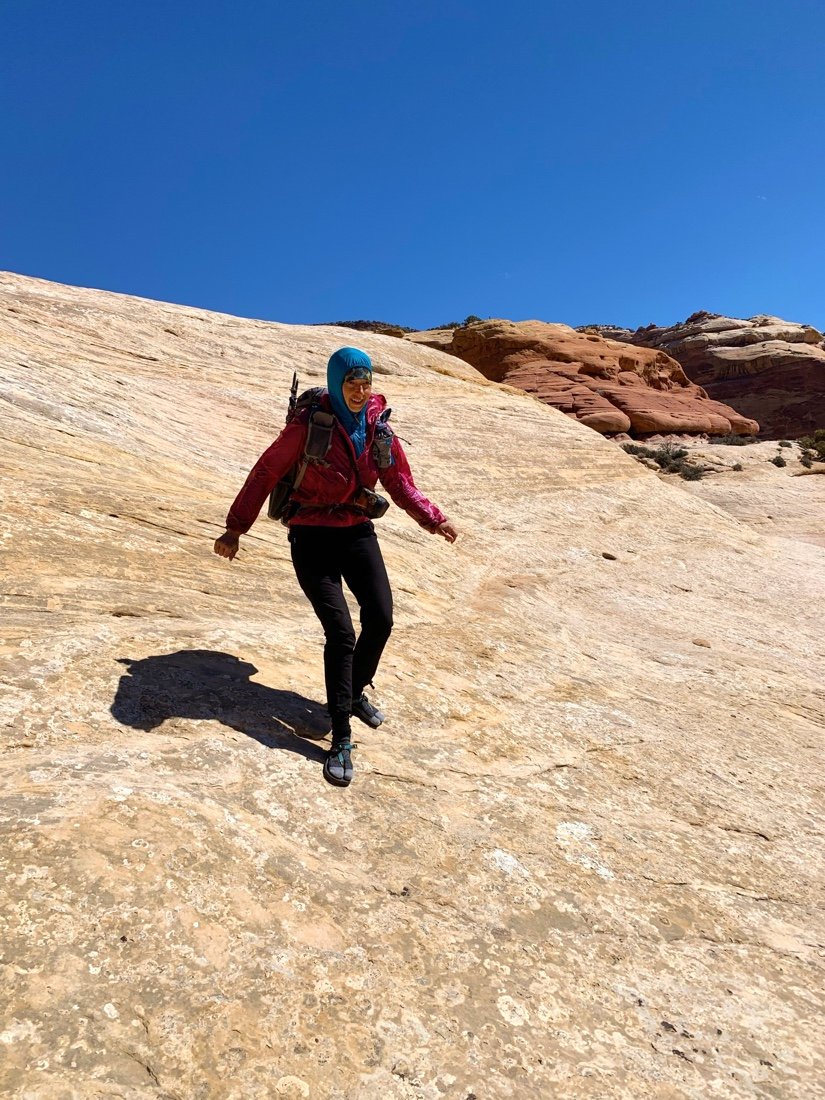
We left Needles Outpost with a plan for an alternate route of an alternate route, to avoid camping in Canyonlands. We got a ride to Beef Basin Road, and then took a side road over to Lavender Point, to a bench about half way up. The colors changed from pale to bright and back again, as the clouds came and went. The wind was relentless, and we hid behind bushes during rest breaks.


We camped beneath a red bench to break the wind, but the wind still whipped through the night. I tossed and turned, my thoughts restless from the loss of my mother—my sadness consistently turning to how she passed right before moving to the town where my sisters live. I know she wanted, more than anything, to live near her kids again, and she left this world before she had that time. It feels so wrong to me to have her go right at the start of that inspired joy, having it ripped out from under her, in the moment of it happening. I’m having a hard time letting that go...

It was cold when we woke. We hiked below Cedar Mesa along the rim of Davis Canyon. Davis Canyon is stunning, swirls of pink and white, rounded sandstone, twisting and turning canyon bends that came to life as the sun rose. We rounded Cedar Mesa and got the first view of the ridge our route took to Fisheye Arch. I never saw Fisheye Arch.

• Looking into the end of Davis Canyon. •

• Looking down into an unnamed canyon between Davis Canyon and Salt Creek Canyon. •
The wind howled, growing stronger with every step. As we reach the thin peninsula of rock our route traversed across, the wind was nearly knocking me over, and we came to the first difficult move—a thin slanted ledge, where we had to step around a bulge, with Mount Washington New Hampshire force winds. I couldn’t do it, at least not with my pack on. Neon waited for a short lull in the wind, then took his pack across. Then he came back for my pack, and I followed close behind, looking only at the next step, and specifically not down at the death fall. I forgot all about my mother in that moment. There was no room for anything but being present for the rest of the descent.

• Looking down into Big Pocket. •
The wind howled—I walked in a shortened waddle, knees and hands out and low, with my butt prepared to drop at the slightest tipping from the wind. In the middle of the peninsula, the wind grew to 80 mph. I know this kind of wind from climbing Mount Washington in New Hampshire in the winter. If I go down at that speed I can’t get back up. Neon is a rock and kept me moving, tugging at my wind jacket. We finally made it behind a small bench that blocked enough wind for me to catch my breath. There was no going back now—we were committed to the rest of the descent off this hunk of sandstone.
• Neon, checking out the next part of the route across the peninsula. •
We crossed the rest of the thin peninsula, reaching another steeply slanted traverse under an overhang, mostly out of the wind. I was almost through when I reached the last few steps—loose sand froze me in place. “I don’t think I can do it. My foot isn’t holding”, I said. Neon took a few steps back and pulled on my jacket—I moved quickly forward, off the sand, and back onto solid rock. It was more level here and nestled with a few bushes. We stopped for a short break.

• Looking back on the windswept peninsula from our protected break spot. •
I saw several route cairns below us. It looked easier from here. And it was, for a little while. Several more preposterously steep sections followed the easy parts. One by one, we made our way through them. When we finally made it down, we looked at each other and said “Wow, what an awesome route! But let’s never do it again! ...at least not with full backpacks.”

• Neon heading down an easy slope. •

• Pulling our packs down from a steep incline.•

• We managed to keep our packs on for the last few steep inclines. •
We hiked the last few miles of Salt Creek Canyon, stopping at an old ruin site nestled into the side of a cliff, and at an old cabin on Salt Creek. We found water at the junction of Salt Creek and East Fork Salt Creek. We made it past the boundary of Canyonlands and set up camp between a few juniper bushes.


The sun was warm and we decided to cowboy camp. I woke cold in the night, turning over and over from cold hip bones. By dawn I noticed I had ice between my sleeping bag and my sleeping bag cover. I wasn’t frozen but I wasn’t warm either. It was 20°F. We didn’t move until the sun shined on the earth beside our camp. It was a slow start to the day. As we were leaving camp I found a roughly fashioned red arrowhead. This first week has been amazing that way.


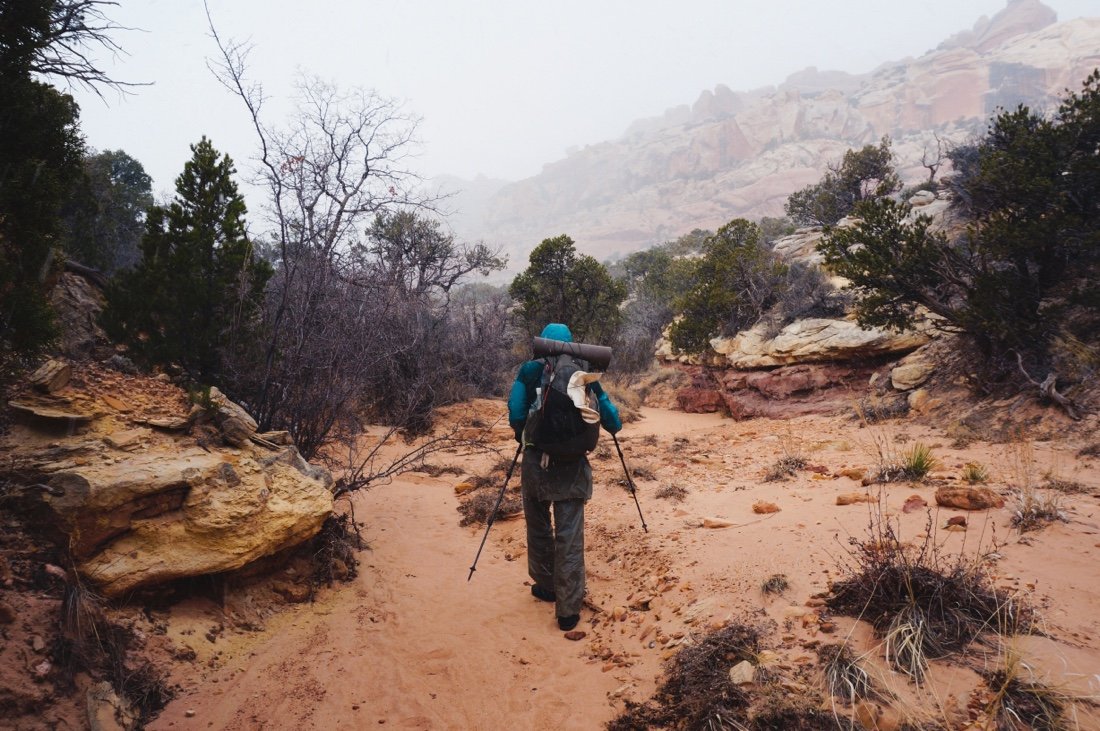
Twenty minutes into the day’s hike, a gray cloud rose over the canyon walls, blocking the sun. It started snowing before I’d even fully gotten warm from the cold night. A half an hour later the sun came out and the snow had passed over us. This pattern continued through the day. We joked about being in shorts by the afternoon, but it never happened. It was a slow day with continuous route finding challenges; cross-country, between trees, over ridges, through canyons, snow, mud, and rocky descents. We barely made ten miles.


The sun came out long enough to set up camp. By the time we crawled into the tent, the temperature had already dropped to 30°F. I wore everything I had to bed, including my rain gear. I woke shivering in the night. I curled up closer to Neon. I stopped shivering. It was 16°F when we woke, and the tent was covered in crystally snow.

We stayed huddled together until the sun hit the tent. We packed up camp with frozen fingers and shuffled off in the snow, stopping in the sun every few steps to check which way to go through the rocky forest. We took a long, sunny, basking break at 42°F in Ruin Canyon. Another slow day. It was 1:00 pm and we’d only come three miles.


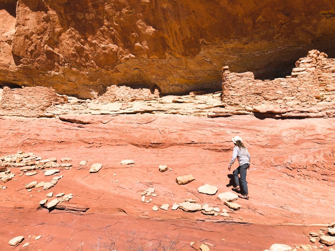
I’ve done this part of the Hayduke route before and I was looking forward to seeing the old dry-stacked stone tower again at the end of Ruin Canyon, but I wasn’t looking forward to the part that came after that—a steep climb up a rocky cliff side with a few fourth-class moves. I was hoping this time it would be snow free, but with all the snow the last couple of days I knew it wouldn’t be.


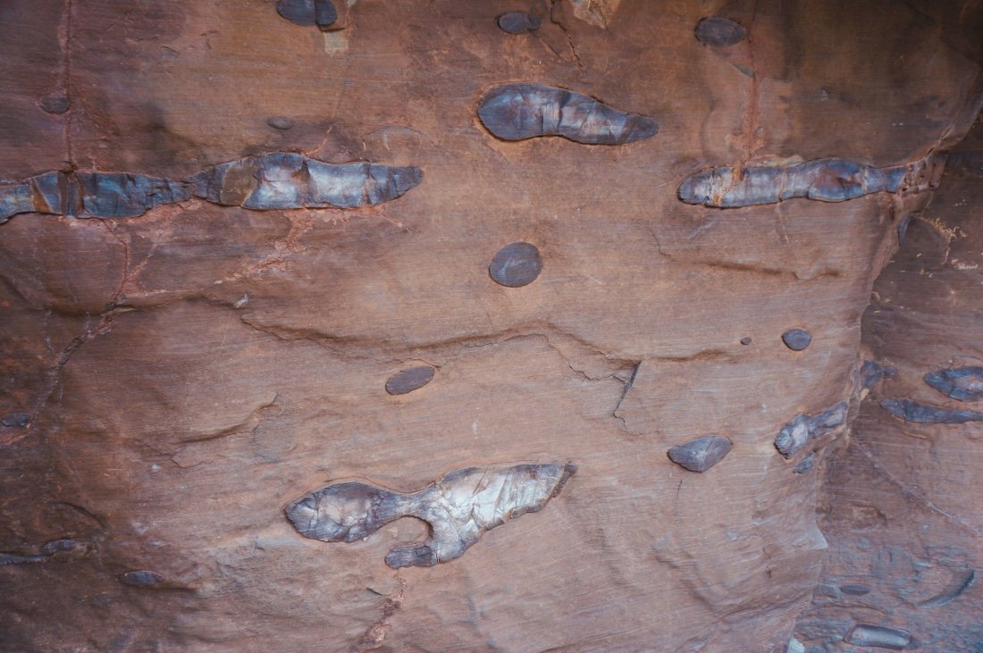
• Old piece of pottery, Ruin Canyon. •
We followed bobcat tracks up the cliff side. Slipping in all the same places the bobcat did. I’ve had this experience before, on the Continental Divide Trail, following a wild animal’s tracks through a difficult section. I find it comforting to know that the wild animals that live in these places—places they’ve evolved to succeed in—struggle in many of the same difficult parts that I do. We made it to the top, tired and frustrated from tricky moves over rock and snow.

We pressed on through the sparse forest, up over down and across endless finger ravines. We made it to a road and to the top of Trail Canyon. It was already early evening when we started down Trail Canyon, but we wanted to make some more miles to get to a lower elevation, and hopefully to warmer temperatures. It was warmer, but not warm. The nine mile day felt like twenty.

Having done this part of the route before, we knew it got easier from here. We reached Woodenshoe Canyon and water by second breakfast. The trails through this end of Dark Canyon are easy to follow, and the miles were finally passing by much more smoothly. I could feel my ribbon returning, and my thoughts occasionally wandered off to visit my mother. We camped on a sandy bank above the creek bed. It rained in the night, clearing by morning.


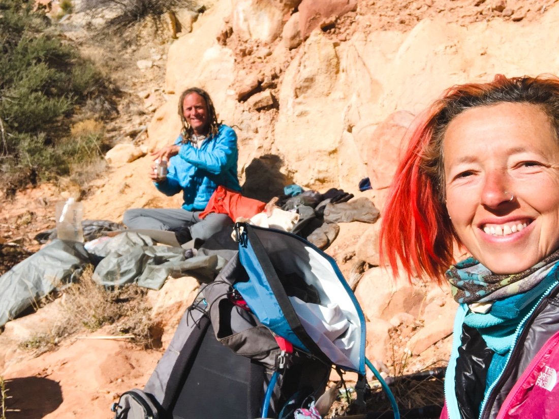
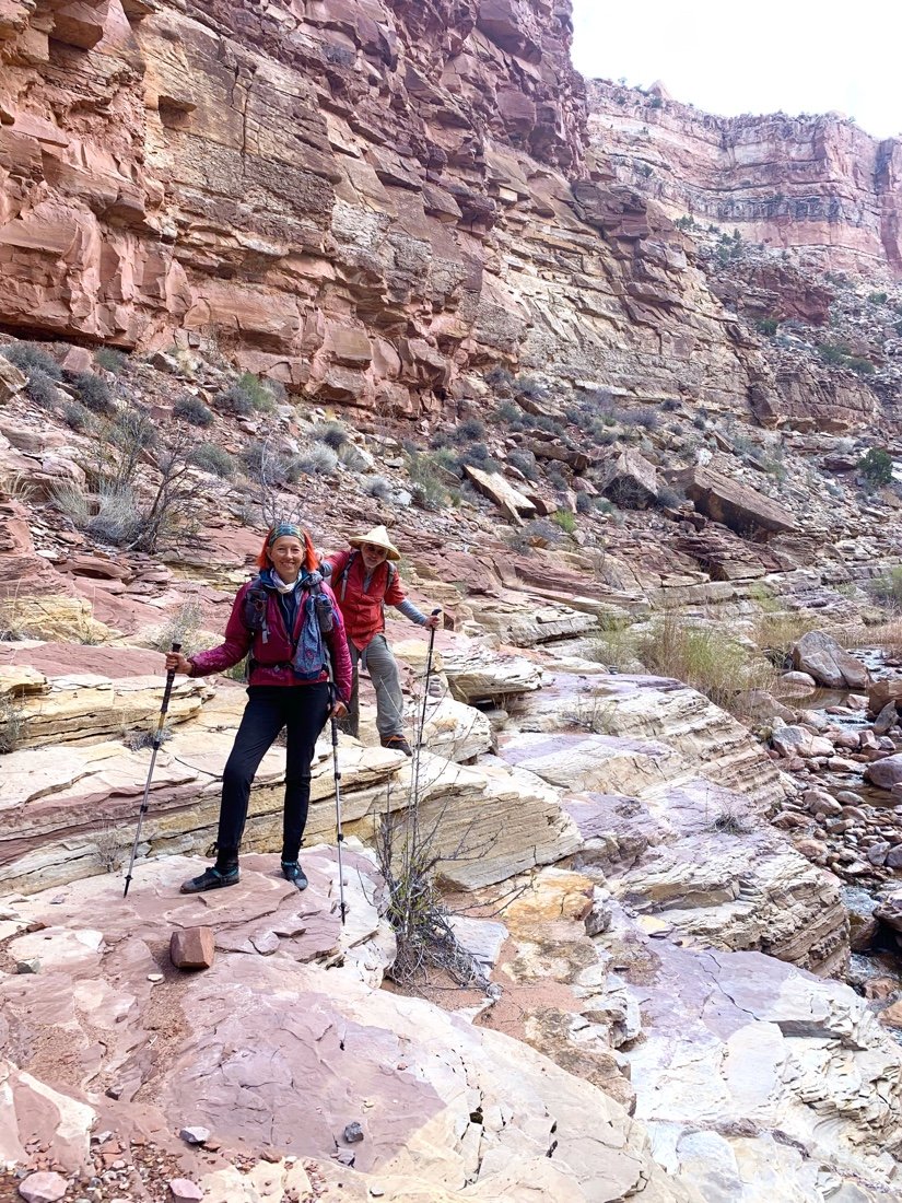
We thrashed through wet willows and wet sand through the morning, stopping in the sun for second breakfast near Young’s Canyon. Mid break, we heard a voice. Brian, Wolverine, had just wandered out of Young’s Canyon. We had set our food caches with Wolverine on the drive across Utah, but started in different places from Moab. We all hiked together for the rest of the day, sometimes on trails high above the creek, and sometimes on rock shelves beside the creek.


We made it out of Dark Canyon to the top of the Sundance Trail in time for sunset. We all cowboy camped near the cliff. It was warm. A raven soared around overhead, voicing its presence at every turn. I could feel myself feeling relieved that tomorrow was just a road walk, and we’d be at our second food cache by mid afternoon.


I woke early, right at dawn, thinking about the soy milk and Indian food I had put in my cache to eat while I unpacked and repacked all my trail food. We reached the dirt road just after second breakfast. I pulled out my headphones, and was instantly transported—I didn’t have to pay attention to the route now—I could just walk and be with my thoughts, my mother, and glide across the landscape like the hawks.

The road miles passed quickly. The music pulled the tears from my tightly buried grief. In a gasp of tears I held my hand to my mouth, and leaned onto my trekking poles. I took a deep breath, letting it out slowly, before pressing on. A truck passed, and a guy leaned forward and waved. I smiled and waved back, jolted back to my surroundings. Each new song took me to a new place. I walked in and out of tears, free to just walk and think again.