
TEMBR 1: Dirt Roads & Epic Hike-a-Bikes
"Tulcan to Tumbaco" I've been looking forward to the bikepacking.com Trans Ecuador Mountain Bike Route (TEMBR) long before we ever began this adventure. I visited Ecuador on a mountaineering trip twelve years ago; I fell in love with its mountain landscapes then, and have wanted to come back ever since. As soon as we crossed the border into Ecuador I could feel the mountains calling me. It was immediately different than Colombia.Before beginning the TEMBR, we stopped in to see the Tulcán cemetery, a tourist attraction known for its topiary sculptures. The topiary sculptures were started by the cemetery’s gardner, Josè Maria Azael Franco, in 1936. He passed away in 1985, but his work, and the tradition of topiaries, still continues today.


 Our plan is to follow parts of both the dirt road and singletrack versions of the TEMBR down to Peru. The TEMBR dirt road version begins in downtown Tulcán, and within just a few short hours climbs high into the Paramo on old cobblestone roads, past farmland, through tall pampas grass, and into frailejones, as far as the eye can see, in the El Angel Ecological Reserve.

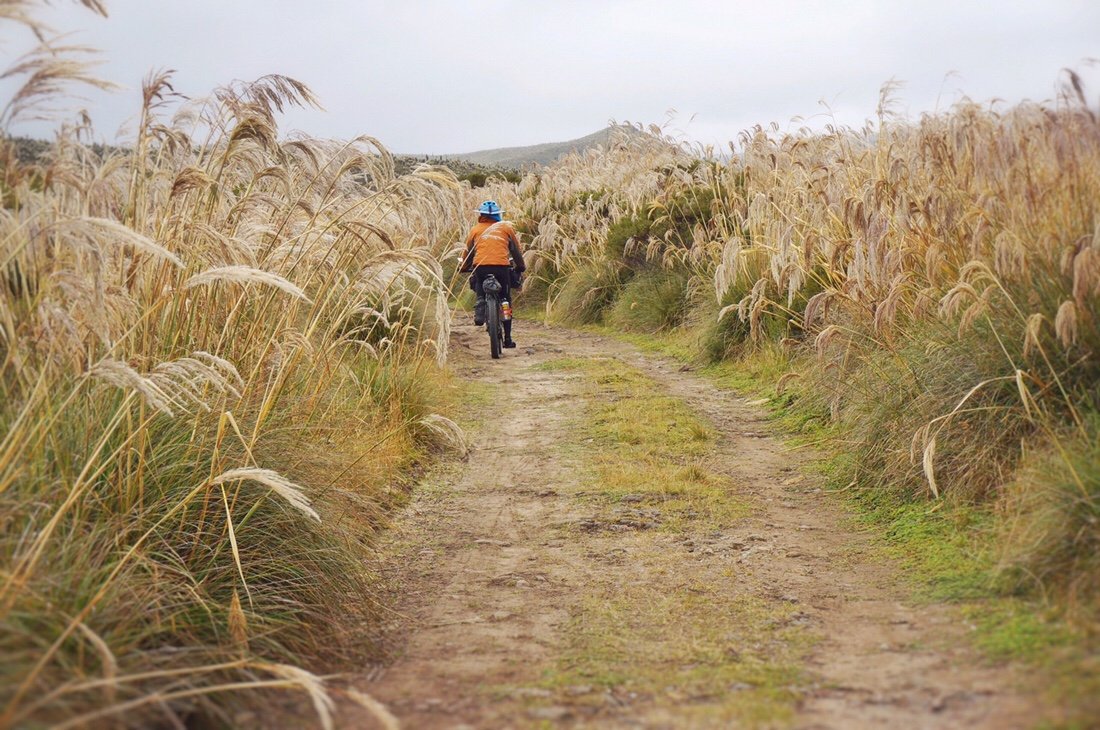


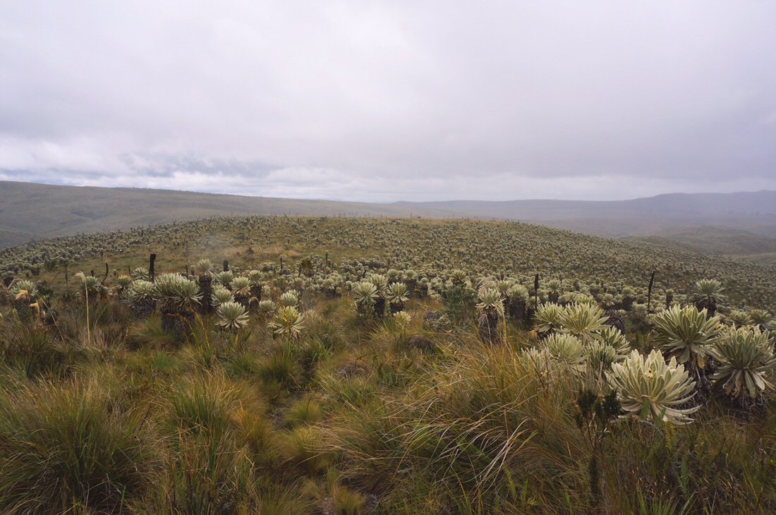 The "paramo" is a tropical alpine zone (~3000 to ~5000 meters); it is divided into sub zones characteristic of different types of vegetation. We travelled through different zones including grasses, small and large (including pampas grass), shrubs, and frailejones.
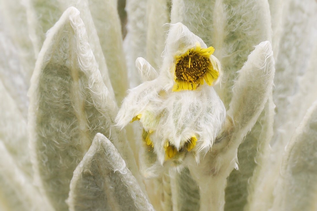 Frailejones (espeletia) are a perennial subshrub in the sunflower family. Their fuzzy leaves protect them from the cold and help to capture water vapor, transporting water into their trunk, down to their roots, and into the soil, making them a recognized and important part of the world water cycle.


 It's pretty special to have the opportunity to travel through the paramo, and through such dense populations of frailejones. Frailejones, like many key plants around the world, are endangered due to land use history. They're beautiful, and mysterious plants. It's an enchanting experience to spend so much time with them.


 We arrived at the El Angel Ecological Reserve guard station in time for sunset. It was raining and the guard on duty offered to let us sleep in the picnic pavilion, a welcome offering considering the weather.
 It was still raining when we woke. The clouds were so thick we could hardly see fifty meters. We had planned to hike to the lakes, Lagunas El Voladero, but considering the visibility, and the icy rain, we decided to just pedal onward to lower, and warmer, elevations.
 ...looking ridiculous in my ultrasil rain gear. I made this rain gear back in 2012 for my thru-hike of the Pacific Crest Trail, and have since used it on all my thru-hikes, mountaineering adventures, and international travels. It might not be magazine pretty but it's kept me warm on more adventures than I can count.•
 We dropped down below the clouds, stopping to delayer, and warm up with some hot food, in the town of El Angel. The dirt road version of the TEMBR continues around through Buenas Aires, but it's currently suggested to not go that way due to security issues related to illegal mining. We decided to leave the TEMBR dirt route at San Isidro, passing through Mira, dropping down to the Panamerican Highway, then over to Salinas to the start of the TEMBR singletrack route.
 ...if my bike had wings! Because this is what it feels like to ride through the mountains.•
 A gang of dogs in Mira. Thankfully this gang paid us little attention.•
 Dropping down to the Panamerican Highway, Imbabarra in the distance; we could see this mountain for days.•
 It got hotter, and dryer, as we dropped down to the Panamerican Highway. We started with freezing rain in the El Angel Ecological Reserve in the morning, and by midday we were in a hot desert environment surrounded by fields of sugarcane (and tiny biting flies).•
 We arrived in Salinas, hot, thirsty, and tired. The town had an abandoned kind of charm, "muy tranquillo", as locals might say, but it was a tough place to find food. The few restaurants were all closed, and the stores had little to offer more than potato chips and cookies. We did score some peaches, but I went to bed feeling hungry, and a little nauseous from the greasy sugary snacks.
 I woke sick in the night, several times, puking until dry heaves ensued. We had planned to start the singletrack route from Salinas, but with the lack of resupply, feeling sick, and the only available hostal being on the dingy side, we decided to ride south to Urcuquí. It was a hot climb to get there, I was feeling pretty ill, and the tiny biting flies kept me in a bit of a panic the whole way. I was happy when we arrived in Urcuquí, to a charming little town, and a very comfortable, clean, and cheap hostal. And best of all: tons of shops with good food, and an abundance of produce.
 I spent three days in Urcuqui, healing myself with all this produce (and more), plus lots of Lulo (naranjillo) and granadilla.
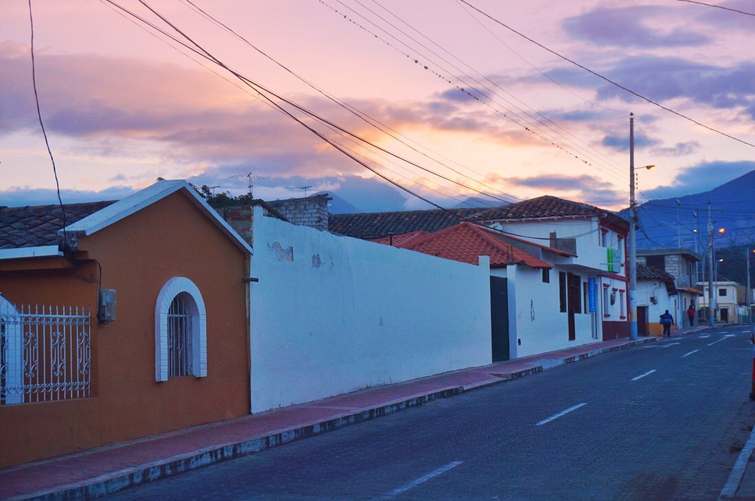 Sunset in Urcuquí, looking up toward the mountains we would climb into.•We contemplated backtracking to the start of the singletrack route, but since it starts with an epic hike-a-bike, supposedly one of the most challenging on the route, we decided to explore and find a different route up into the Cotocachi Cayapas Ecological Reserve. Our route didn't turn out to be any easier, and it may well have been more difficult. But I had a great time exploring, and climbing up into the mountains, which seems to be my favorite thing to do regardless of how I get there.
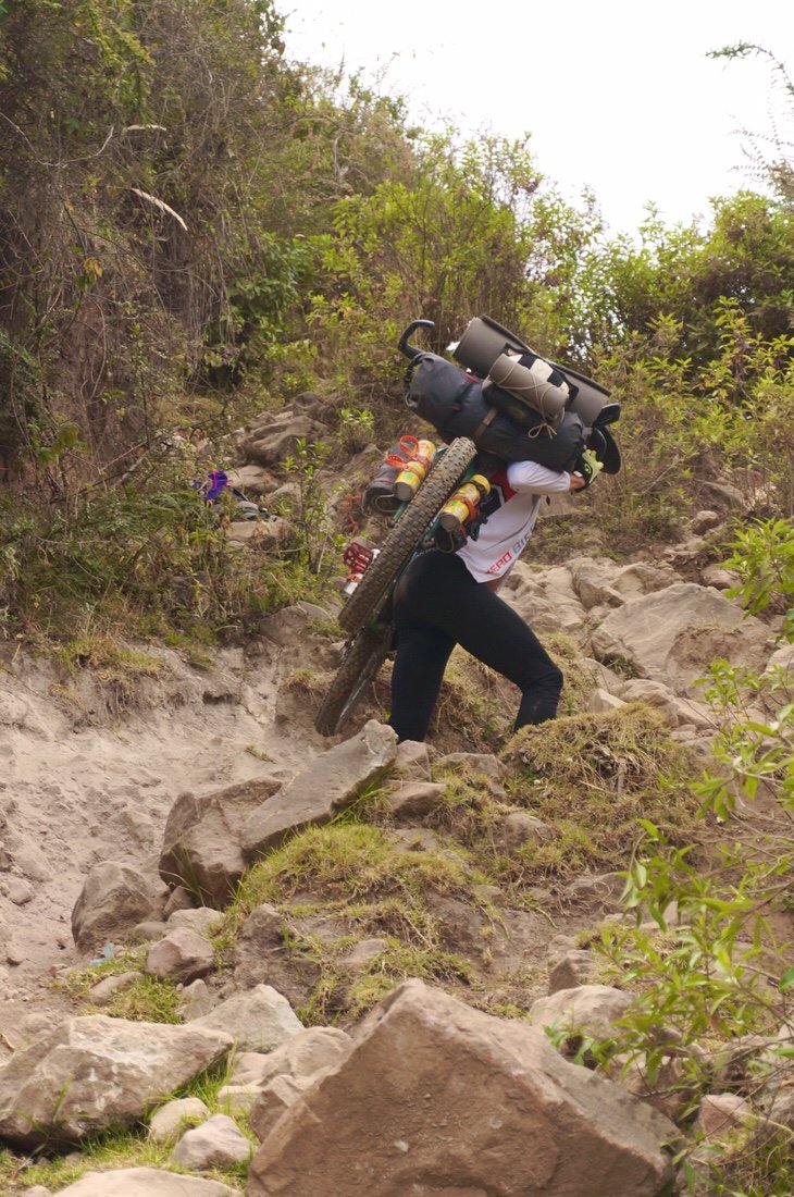

 After some strenuous hike-a-bike we met up with a road, which we could see continued all the way down to the valley we had just pushed, shoved, tugged, and carried our bikes up from. Neon turned to me and said, "well, now don't I feel stupid". By this point we were already exhausted so we altered between riding, and pushing our bikes some more. Near the end of the day we came to a gate; it was unlocked, but it had a big sign declaring it was private land and only authorized personnel could enter. It was late on a Friday and no one was around. We only had another two kilometers to the border of the ecological reserve, so we continued through the gate, up the road, to the edge of the reserve where we found a secluded spot to camp tucked away in a pine forest.
 The next morning we followed the road for a short ways before it ended. A man on a horse passed us and headed up into the bushes. We followed, finding more epic hike-a-bike trail.

 The morning faded to afternoon as we strained our way higher into the clouds. By this time Neon was cursing his heavy bike. I'd spent the last year lightening up my bike just so I could do this very thing--so while it was a lot of work, it still felt within my capabilities, and in some perverse way, I was actually enjoying it.
 If you zoom in on the above photo you can just make out a tiny Neon, on the left trail, heading up toward the notch.
 Gaining yet another rise/pass in the landscape; Neon was pretty over it by this point.
 Descending down to a small valley/meadow, we hooked up with the TEMBR singletrack route.
 As we descended into the valley/meadow a condor soared overhead. I was already pretty stoked to be here, but the condor made it feel all the more special.
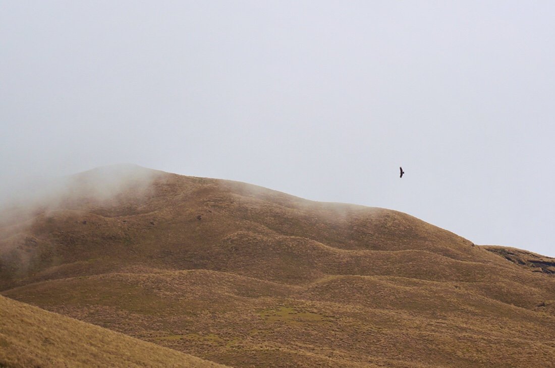 We took a break for a late lunch, watching two condors soar above the valley/meadow.
 You can just make out the white on the condor's wings, to the left, and a little above, of the little barn.
 We climbed out of the little valley/meadow, pushing our bikes across a ridge for what was probably another hour or two before we came over another rise where we caught our first glimpse of Yanaurcu de Piñan. I was beyond stoked at this point. Not only had I been able to get my bike here, something I wasn't sure I had the strength to do, but the condors, the mountain, and the cloud tease were pure magic.
 We'd only made seven and a half kilometers by three in the afternoon, but we decided to call it a day, and set up camp with the perfect view of Yanaurcu de Pińan.

 We lingered the next morning, partially because we were tired, but I also didn't want to leave this magical place. Someday I'll come back to climb this beautiful mountain.
 We were able to ride short parts across the paramo, but there was still more rutted "trail" to navigate, and the thick paramo grass to get through. As we crossed the open paramo three condors soared overhead. I thought condors were a pretty rare sight, but we must have had perfect timing.
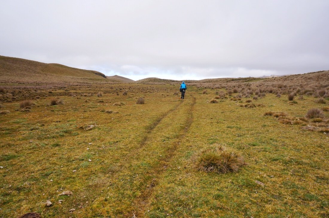
 That's me, reaching up through the tall bunches of grass. My bike is in there somewhere too!
 I was pretty jealous of Neon being able to carry his bike; I found the tall grass much more difficult than the ancient trails we had pushed our bikes up the day before. With a broken back, carrying my bike isn't really an option for me, not for long distances anyway.
 After weaving and tugging our bikes through the tall grass, for at least an hour, probably two or three (for me anyway), the road, where the singletrack and dirt road route meet for the first time, finally came into view. A very welcome site.
 Just before gaining the road I came across these large green mounds. At first I thought they were Llaretta, azorella compacta, a plant that grows in Bolivia. Some of the llaretta mounds in Bolivia are estimated to be ~3,000 years old. But after a little internet research it seems llaretta doesn't grow in Ecuador. But it is an azorella, I just don't know which species.


 We finally gained the road, three hours after we left camp. We stopped for a short snack break on the side of the road; two more condors soared overhead. Maybe we were seeing the same ones; I don't know, but I was feeling pretty lucky at this point. We headed down the road; It was great to be pedaling again. We had a fast descent down a steep dirt road, before cutting across farmer's fields, then along a canal.
 Neon looking down into the steep, deep, gully under the canal "bridge".
 __
__ We set up camp at the edge of the canal, not wanting to rush into town after such a magical mountain experience.
 The next day we followed cobblestone roads down into the valley, stopping in the town of Cotacachi for second breakfast before continuing on to Otavalo.
 Neon asking a local in Cotacachi where we might find a place to eat. It's interesting because when we ask people this question they always give us directions to a specific restaurant, presumably their favorite one, or perhaps a restaurant of a friend. This lady gave us directions to a place several blocks away with several turns to get there, but when I looked around the square we were surrounded by restaurants.•We spent a couple of days resting up in Otavalo. It was a bit touristy, and kind of expensive, but we were pretty exhausted from the epic hike-a-bike. We left town on a cobblestone road, following the TEMBR dirt road route, to Lagunas Mojanda.
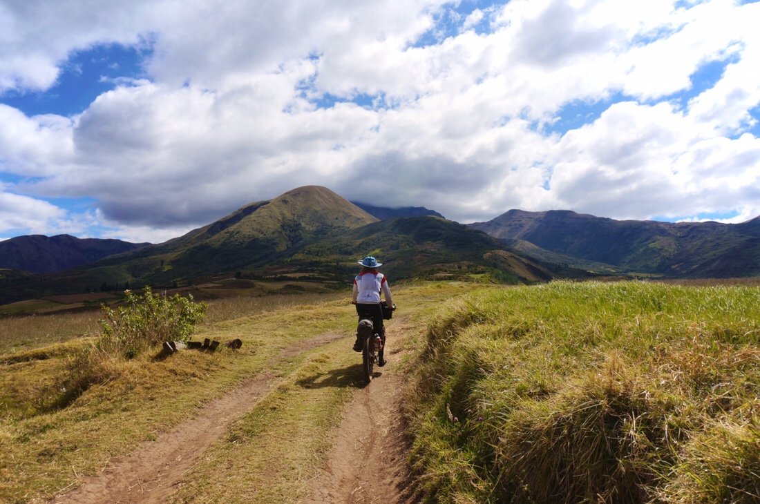
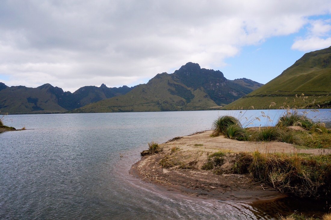
 It wasn't as remote as Yanaurcu de Piñan, but it was still beautiful, and by this point the whole experience was feeling a little surreal for me. What a place to be: "riding" my bike through the mountains of Ecuador.

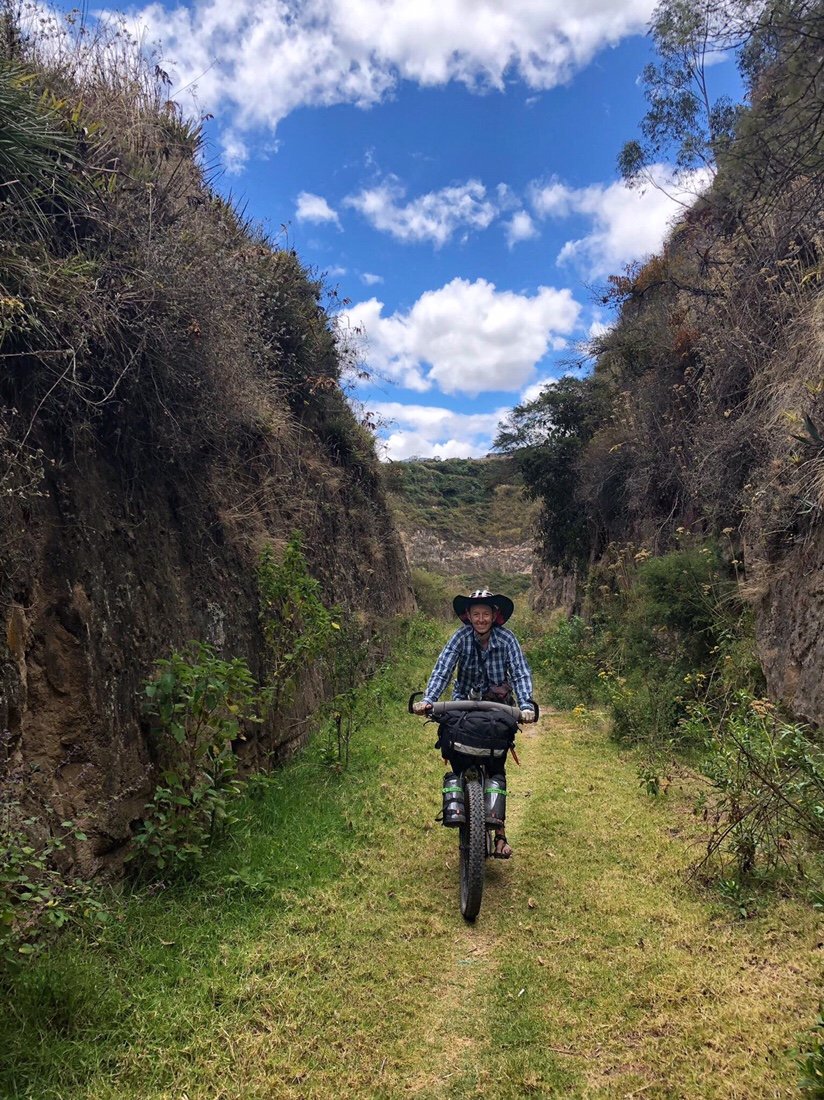
 The next day we continued down a rough dirt road from the lakes, took a wrong turn on a horrible trail, then pushed/tugged/dragged our bikes up a 'way too steep' hillside to get back to our route, then continued on more dirt roads, through a few small towns, cross country when the track dead ended, through a giant metal gate, a little pavement, more dirt, then onto a big highway, where we crossed the equator!
 No special monument, but here's us at the equator!•We arrived in Guallabamba midday, got a room in a hostal at the edge of town, and collapsed, in what to me felt like a blurry whirlwind, like looking out a window to see the landscape still zooming past, except I wasn't moving anymore. I'm riding a pretty high buzz on this route. It's pushing some buttons for me, perhaps it's that I've been away from home for so long now, or maybe I'm already mourning the passing of this experience as it fades into yesterday.We left Guallabamba on two track, following a gentle grade to El Quinche, where the route follows an old rail line all the way into the Quito suburbs. It's a bit rough in places, between El Quinche and where it crosses the Panamerican highway, but it's popular with local mountain bikers. We crossed paths with several groups of mountain bikers; we got lots of waves and thumbs-ups, and questions about where we’re from and where we’re heading to. After crossing the Panamerican highway the rail line is part of the city park system; it’s well marked, groomed, and a fun way into the Quito suburbs.
 __
__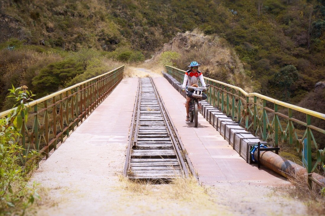 After this bridge a tunnel was blocked. There are two options: a very steep trail, up, to go around the blocked tunnel, or a pretty level traverse around the blocked tunnel on a narrow "trail" across a steep, loose, cliff side. I chose the steep cliffside.
 There were several more tunnels, all clear, some short, some long and dark. Near Iguiñaro part of the rail line is blocked by a landslide, but since the "rail trail" is popular with local mountain bikers there is a partially cleared smooth track through part of it.

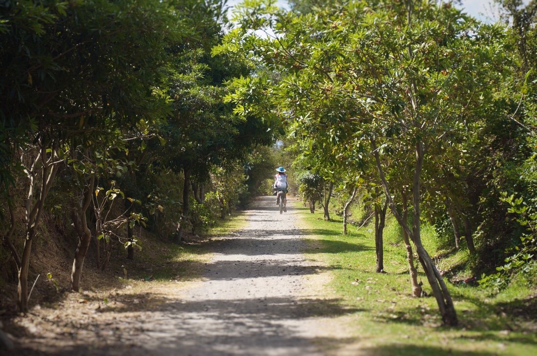 The "rail trail" is perfectly groomed after crossing the Panamerican Highway. The last ~15 kilometers into Tumbaco were part of the city park system ( ruta ecological, el chacuiñan) and a real joy to ride, nothing epic, just beautiful, fast, and fun.•
 We stayed at the Casa de Ciclistas in Tumbaco. Santiago (on the right) was a great host. He does quality work and fixed my bike up good as new. There were only a few other cyclists while we were there, but it was enough to rekindle a small sense of community for me. I’ve really been missing that on this adventure, feeling connected to something... hanging out and chatting with like minded folks was just what I needed. And the timing worked out perfect to hook up again with Brad (bikehikesafari.com). He's not only cycling from Alaska to Argentina, but he has also thru-hiked some of the same long trails that we have so we had a lot to talk about.
 •
• Giant bike sculpture--must climb! It might be too big for an epic hike-a-bike though..._NEXT UP: The Los Tres Volcanos route, a variation on the TEMBR singletrack route._____________________For more frequent updates, follow me on Instagram at: instagram.com/theredheadednomad•You can also find me on facebook at: facebook.com/redheadednomad•You can sign up to receive The Redheaded Nomad’s blog posts in your email inbox; sign up at the bottom of any page on my website: theredheadednomad.com•If you enjoy my posts and would like to make a contribution toward my travel expenses, or just buy me a coffee in appreciation, you can send an amount of your choosing through my paypal.me address:paypal.me/inthewildland_____________________